
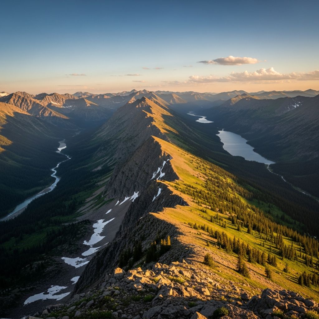
The Continental Divide represents a fundamental geographical feature that dictates the direction of water flow across entire continents, primarily separating watersheds draining into the Pacific Ocean from those flowing to the Atlantic, Arctic, or Gulf of Mexico.
The Hydrological Backbone of the Americas
At its core, a continental divide functions as a high-elevation boundary where precipitation and meltwater choose their paths based on which side of the ridge they land. In North America, this divide stretches impressively from the Bering Strait in Alaska down to the Strait of Magellan at the southern tip of South America, forming the longest such feature on Earth. Water falling on the western slopes rushes toward the Pacific, while eastern slopes feed rivers heading to the Atlantic or northern Arctic waters.
This separation creates distinct river systems. For instance, major western rivers like the Columbia and Colorado carry water westward, while eastern giants such as the Missouri, Rio Grande, and Mississippi direct flows eastward. The divide’s path predominantly follows mountain crests, ensuring that even small droplets of rain follow continent-spanning journeys determined by mere inches of terrain height.
Tracing the Path: From Arctic Peaks to Andean Summits
The journey begins in remote Arctic Alaska near Cape Prince of Wales, south of the Arctic Circle, where the divide marks the initial split between Pacific and Arctic drainages. It then weaves southward through the rugged Mackenzie Mountains, forming part of the Yukon-Northwest Territories boundary in Canada.
In the United States, the divide aligns closely with the Rocky Mountains’ spine, passing through iconic landscapes. It traverses Montana’s Glacier National Park, Wyoming’s Yellowstone National Park, Colorado’s Rocky Mountain National Park, and into New Mexico. Colorado hosts the highest point along the U.S. segment at Grays Peak, exceeding 14,000 feet (4,267 meters).
Southward, it continues through Mexico’s Sierra Madre Occidental, dips into Central America—reaching its lowest elevation in Nicaragua—and climbs the Andes in South America, ending far south. This serpentine route spans over 3,500 miles in North America alone, adapting to varied terrains from icy tundras to tropical highlands.
Multiple Divides Across North America
While the Great Divide dominates discussions, North America features several continental divides. The Eastern Continental Divide separates Atlantic-bound waters from those flowing to the Gulf of Mexico, running from New York to the Georgia-Florida border. The Great Lakes-St. Lawrence Divide further partitions northern watersheds.
These lines occasionally converge at triple points, rare spots where three divides meet, sending water to three different oceans—a hydrological marvel occurring in places like Triple Divide Peak in Glacier National Park.
| Divide Name | Primary Separation | Key Regions |
|---|---|---|
| Great Continental Divide | Pacific vs. Atlantic/Arctic | Rockies, Andes |
| Eastern Continental Divide | Atlantic vs. Gulf of Mexico | Appalachians |
| Northern Divide | Arctic vs. Hudson Bay | Canada’s northern ranges |
Ecological and Climatic Influences
The divide profoundly shapes ecosystems by creating rain shadows—western slopes receive heavy Pacific moisture, fostering lush forests, while eastern sides face drier conditions suited to grasslands and deserts. This bifurcation influences biodiversity; western drainages support salmon runs in Pacific rivers, while eastern systems host diverse freshwater species in the Mississippi basin.
- Western Watersheds: High precipitation supports coniferous forests, alpine meadows, and anadromous fish migrations.
- Eastern Watersheds: Variable climates yield prairies, wetlands, and species adapted to floodplains.
- Mountain Ecosystems: High elevations host unique flora like Engelmann spruce and fauna such as mountain goats.
Climate patterns hinge on the divide too. Orographic lift on windward sides generates snowfall that feeds rivers year-round, critical for water supply in arid west. As climate change intensifies, altered snowpack could disrupt these balances, affecting downstream agriculture and cities.
Human History and Cultural Significance
Indigenous peoples have navigated the divide for millennia, using passes for trade and migration. European explorers like Lewis and Clark crossed it in 1805 at Lemhi Pass, a pivotal Westward Expansion moment symbolizing the frontier.
The divide symbolized America’s manifest destiny, dividing ‘East’ from ‘Wild West’ in cultural lore. Railroads like the Northern Pacific pierced it via Marias Pass, enabling transcontinental connectivity. Today, it draws hikers on the Continental Divide Trail (CDT), a 3,100-mile path from Mexico to Canada through stunning parks.
In popular culture, the divide evokes adventure, featured in literature and films as a line of destiny where East meets West.
Notable Landmarks and Peaks
Several sites highlight the divide’s grandeur:
- Grays Peak, Colorado: Highest U.S. point at 14,278 feet, offering panoramic views.
- Triple Divide Peak, Montana: Waters flow to three oceans, a hydrological triple point.
- South Pass, Wyoming: Oregon Trail crossing, low-elevation gateway for pioneers.
- Yellowstone’s Two Ocean Plateau: Streams split to Pacific and Atlantic directly.
These spots underscore the divide’s variability—not always towering peaks but sometimes subtle ridges.
Global Perspective: Divides Beyond the Americas
Every continent except Antarctica hosts divides. Europe’s main one separates Rhine (North Sea) from Rhone (Mediterranean) flows along the Alps. Asia’s vast networks split Himalayan waters to Indian, Pacific, and Arctic Oceans. Africa’s divides direct Congo to Atlantic versus Nile to Mediterranean.
These features define global hydrology, influencing trade, agriculture, and settlements worldwide.
Modern Challenges and Conservation
Development pressures mining, logging, and roads threaten the divide’s integrity. The CDT faces overuse, while climate shifts alter water availability—western droughts strain Pacific rivers, eastern floods burden Mississippi systems.
Conservation via national parks and trails preserves this heritage. Organizations monitor watershed health, advocating sustainable practices.
Frequently Asked Questions (FAQs)
What exactly defines a continental divide?
A continental divide is a drainage boundary separating river systems flowing to different oceans or seas, primarily along mountain crests.
Where does the North American Continental Divide start and end?
It begins at the Bering Strait in Alaska and extends south through the Rockies, Central America, and Andes to the Strait of Magellan.
Can you drink water from both sides of the divide?
Yes, but water from one side reaches the Pacific, the other the Atlantic—proving the divide’s subtle power.
How does the divide affect weather patterns?
It creates rain shadows, with wetter western slopes and drier east, influencing climates and vegetation.
Is the Continental Divide Trail the entire divide?
No, the CDT is a 3,100-mile hiking trail paralleling much of the U.S. portion, not the full Americas-spanning feature.
Visualizing the Divide: Key Statistics
| Aspect | Details |
|---|---|
| Total Length (Americas) | ~19,000 km / 11,800 miles |
| U.S. States Crossed | 5 (MT, WY, CO, NM + others) |
| Highest Point (U.S.) | Grays Peak, 14,278 ft |
| National Parks Along Route | Glacier, Yellowstone, Rocky Mtn |
References
- Continental Divide Definition & Meaning — Dictionary.com. Accessed 2026. https://www.dictionary.com/browse/continental-divide
- Continental Divide of the Americas — Wikipedia. 2026-04-05. https://en.wikipedia.org/wiki/Continental_Divide_of_the_Americas
- Continental Divide — Britannica Kids. Accessed 2026. https://kids.britannica.com/kids/article/Continental-Divide/346100
- Continental Divide — Wikipedia. 2026-04-05. https://en.wikipedia.org/wiki/Continental_divide
- Geography of the US Continental Divide — Study.com. Accessed 2026. https://study.com/academy/lesson/geography-of-the-us-continental-divide.html
- What is the Continental Divide, and Why Does It Matter? — MagellanTV. Accessed 2026. https://www.magellantv.com/articles/what-is-the-continental-divide-and-why-is-it-important
- Geography of the US Continental Divide Video — Study.com. Accessed 2026. https://study.com/academy/lesson/video/geography-of-the-us-continental-divide.html

Medha Deb is an editor with a master's degree in Applied Linguistics from the University of Hyderabad. She believes that her qualification has helped her develop a deep understanding of language and its application in various contexts. Medha specializes in the areas of beauty, health, sports, and wellness and is committed to ensuring that the content on the website is…