
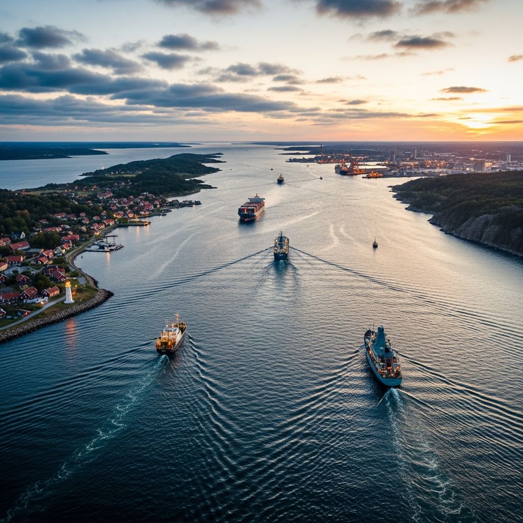
Understanding the Kattegat: A Northern European Maritime Nexus
The Kattegat represents one of Northern Europe’s most significant maritime features, functioning as a crucial corridor that links two of the continent’s most important sea systems. Spanning approximately 30,000 square kilometers, this body of water occupies a strategic position in the Skagerrak-Kattegat strait system, creating an essential passage between the Baltic Sea and the North Sea. The region’s name carries an intriguing etymology, derived from Dutch linguistic roots where “kat” means cat and “gat” refers to a throat or opening, a designation that aptly describes the narrow, constricted configuration of this waterway.
Geographic Boundaries and Physical Characteristics
The Kattegat is bounded by distinct geographical features that define its maritime character. To the west, Denmark’s Jutlandic Peninsula forms a natural boundary, while to the east, the Swedish provinces of Bohuslän, Västergötland, Halland, and Scania create the opposite shore. The northern section connects with the Skagerrak, which ultimately communicates with the broader North Sea, establishing the region’s northern maritime gateway. The southern boundaries are defined by multiple straits that serve as conduits to the Baltic Sea. These include the Øresund strait to the southeast, and the Great Belt and Little Belt passages to the southwest, creating a complex network of water routes that facilitate regional connectivity.
The Kattegat extends more than 340 kilometers along a north-south axis, demonstrating considerable linear distance despite its relatively narrow width. This elongated configuration presents unique oceanographic and navigational characteristics. The average depth of 23 meters makes the Kattegat considerably shallower than many major European sea areas, a factor that has historically influenced navigation patterns and created specific challenges for maritime traffic.
The Sound: A Vital Commercial Corridor
The Sound, connecting the Danish island of Zealand with Sweden’s southwestern coastline, represents one of the world’s busiest sea lanes. Extending approximately 110 kilometers in length, this waterway serves as the primary connection between the Kattegat and the Baltic Sea, facilitating immense volumes of international commerce. Major cities positioned along this corridor—including Copenhagen, Helsingør, Malmö, and Helsingborg—have developed as thriving maritime centers precisely because of their advantageous positions on this critical shipping route. The concentration of ferry operations and cargo vessels through the Sound underscores its importance to regional and global trade networks.
Historical Navigation Challenges and Modern Solutions
Historically, the Kattegat presented formidable obstacles to maritime navigation. The region’s geological composition includes numerous sandbanks, stony reefs, and shifting currents that created dangerous conditions for vessels attempting passage. During prehistoric and historical periods, these natural hazards deterred safe navigation and limited commercial activity. The shallow, unpredictable waters transformed the Kattegat into a treacherous zone that demanded exceptional seamanship and intimate local knowledge.
Contemporary maritime infrastructure has fundamentally transformed these conditions. Modern navigation solutions have included systematic channel dredging to create safer passage routes, strategic removal of major reefs and obstacles, and the implementation of sophisticated lighthouse networks that provide navigational guidance. These developments have converted the Kattegat from a largely avoided route into a dependable commercial passage capable of accommodating substantial modern vessel traffic. The establishment of port facilities at major cities has further integrated the region into global shipping systems.
Environmental Significance and Biodiversity
The Kattegat functions as a productive marine ecosystem supporting diverse species assemblages. The waters host populations of commercially important fish species including herring, cod, and various flatfish varieties. Marine mammals such as seals and porpoises inhabit the region, contributing to its ecological richness. The shallow reef systems that once hindered navigation now represent critical habitats where fish spawn and feed, supporting the broader food web that sustains marine biodiversity.
The transition zone characteristics of the Kattegat create unique ecological conditions. The brackish waters flowing from the Baltic Sea through various connecting straits mix with the more saline North Sea waters, establishing a salinity gradient that influences which species can survive in particular zones. This environmental heterogeneity produces ecological diversity that attracts scientific attention from researchers investigating marine ecosystem dynamics.
Environmental Degradation and Recovery Efforts
The Kattegat confronted severe environmental challenges during the latter twentieth century. In the 1970s, scientific monitoring identified the region as one of Europe’s first documented marine dead zones—areas where oxygen depletion prevents most marine organisms from surviving. This hypoxic condition resulted from intensive industrial activities, agricultural runoff, and municipal discharge that overwhelmed the ecosystem’s capacity to process excess nutrients.
Recognition of these problems prompted coordinated international intervention. Since 1985, Denmark and European Union institutions have implemented substantial environmental remediation projects aimed at reducing pollution and restoring ecosystem health. These initiatives have produced measurable improvements in water quality and oxygen saturation levels. In 2006, the Kattegat was designated a Sulphur Emission Control Area, requiring vessels to utilize cleaner fuel compounds and thereby reducing atmospheric and marine pollution from maritime traffic. This regulatory framework represents an innovative approach to integrating shipping operations with environmental protection objectives.
Protected Areas and Conservation Designations
Recognition of the Kattegat’s ecological significance has resulted in designation of multiple protected areas throughout the region. Extensive portions of the Kattegat have been incorporated into the Natura 2000 network, representing Europe’s primary system for protecting biodiversity. Additionally, specific zones receive protection under the Ramsar Convention, an international agreement emphasizing wetland and waterbird conservation. These overlapping protective mechanisms reflect the region’s acknowledged importance for maintaining viable populations of sensitive species.
The shallow reef systems receive particular conservation attention given their role as spawning and nursery habitats. These areas support the larval development of commercially important fish species while providing feeding grounds for marine mammals. Protecting these ecological functions ensures the continuity of biological productivity that supports both natural ecosystems and human communities dependent on marine resources.
Major Port Cities and Economic Centers
| Port City | Country | Primary Significance |
|---|---|---|
| Gothenburg | Sweden | Major Scandinavian container and cargo port |
| Copenhagen | Denmark | Regional hub connecting Baltic and North Sea routes |
| Aarhus | Denmark | Container and multipurpose port facility |
| Aalborg | Denmark | Industrial and maritime commerce center |
| Malmö | Sweden | Container terminal and ferry junction |
| Helsingborg | Sweden | Strategic ferry and cargo crossing point |
| Frederikshavn | Denmark | Northern gateway port and industrial center |
International Shipping and Trade Flows
The Kattegat’s role in global commerce cannot be overstated. As the primary passage connecting the Baltic Sea with Atlantic shipping routes through the North Sea, the region handles enormous volumes of containerized cargo, bulk commodities, and specialized cargo. Scandinavian manufacturing, Russian mineral exports, and Baltic agricultural products all traverse these waters regularly. The efficiency of this corridor directly influences logistics costs and delivery timelines for an extensive geographic region encompassing much of Eastern and Northern Europe.
Modern shipping optimization depends critically on the reliability and efficiency of Kattegat passage. Disruptions to navigation create cascading delays throughout European supply chains. Consequently, maintaining the waterway’s operational capacity represents a shared interest among multiple nations and international maritime organizations that oversee European shipping infrastructure.
Geological and Oceanographic Transitions
The Kattegat functions as a critical transition zone between distinct oceanographic systems. The Baltic Sea’s freshwater and brackish character contrasts markedly with the North Sea’s fully saline conditions. This mixing zone creates unique water mass characteristics that influence sediment transport, nutrient cycling, and biological productivity. Quaternary geological history recorded in the region’s sedimentary sequences documents the dramatic environmental transformations that have reshaped northern European geography over hundreds of thousands of years.
Understanding these transition zone dynamics provides insights into how marine systems adapt to environmental gradients. Scientists continue studying Kattegat conditions to comprehend estuarine and transitional marine ecosystem functioning, contributing to broader knowledge of coastal oceanography.
Impact of Fishing Practices on Marine Resources
Commercial and recreational fishing represent significant economic activities throughout the Kattegat region. However, these practices exert considerable pressure on marine populations, particularly given the region’s limited spatial extent and the concentration of fishing effort. Sustainable fishing management represents an ongoing challenge requiring coordination among multiple jurisdictions operating under different regulatory frameworks. The shallow waters and productive habitat make the Kattegat particularly vulnerable to overfishing and ecosystem degradation resulting from intensive harvest practices.
Scientific monitoring programs continue evaluating fishing impacts and informing management policies intended to maintain fish population viability while supporting economically viable fishing industries. This balance between resource exploitation and ecosystem conservation remains one of the defining environmental challenges for the region.
Climate Change and Future Vulnerabilities
The Kattegat faces emerging challenges associated with climate change and environmental variability. Warming water temperatures may alter species distributions and affect breeding patterns for temperature-sensitive organisms. Changes in precipitation and freshwater inflow from surrounding regions influence salinity profiles and estuarine dynamics. Sea level fluctuations associated with climate change may impact navigation conditions in the shallow waters. These interconnected climate-related pressures create uncertainties about long-term ecosystem functionality and maritime operational conditions.
Frequently Asked Questions
Q: What is the Kattegat’s primary geographic function?
A: The Kattegat serves as a vital maritime corridor connecting the Baltic Sea with the North Sea, facilitating international shipping, trade, and regional commerce between Scandinavia and broader European markets.
Q: Why is the Kattegat dangerous for maritime navigation?
A: The shallow waters averaging 23 meters deep contain numerous sandbanks, stony reefs, and unpredictable currents that create hazardous conditions for vessels. Modern dredging and lighthouse systems have substantially mitigated these historical dangers.
Q: What caused the Kattegat’s marine dead zone?
A: Industrial activities, agricultural runoff, and municipal discharge introduced excessive nutrients into the ecosystem, depleting oxygen levels and creating conditions unsuitable for most marine life. International environmental interventions since 1985 have improved conditions significantly.
Q: Which countries have jurisdiction over the Kattegat?
A: Denmark and Sweden share maritime governance responsibilities, with the Kattegat bounded by Denmark’s Jutlandic Peninsula to the west and Swedish provinces to the east. Multiple straits connecting to other sea areas are administered through international maritime law frameworks.
Q: What economic importance does the Kattegat have?
A: The region hosts major international ports, supports significant commercial shipping traffic, and connects Scandinavian industrial centers with global markets. It represents one of Europe’s most economically important maritime corridors.
References
- Kattegat Bay — World Atlas. https://www.worldatlas.com/bays/kattegat-bay.html
- Kattegat — Wikipedia. https://en.wikipedia.org/wiki/Kattegat
- Kattegat Facts for Kids — Kiddle. https://kids.kiddle.co/Kattegat
- The Sound, a busy sea-lane between Denmark and Sweden — Britannica. https://www.britannica.com/video/Views-The-Sound-Kattegat-Strait-Baltic-Sea/-16745
- Kattegat (IHO Sea Area) — Marine Regions. https://marineregions.org/mrgid/2374

- Integrated M.A. in Applied Linguistics, University of Hyderabad
- 5+ years in editorial, instructional, SEO, and research-based writing
Sneha is a relationships and lifestyle writer with a strong foundation in applied linguistics and certified training in relationship coaching. She brings over five years of writing experience to theskillvault, crafting thoughtful, research-driven content that empowers readers to build healthier relationships, boost emotional well-being, and embrace holistic living. Her writing and insights reflect the belief that beauty, happiness, and wellness…