
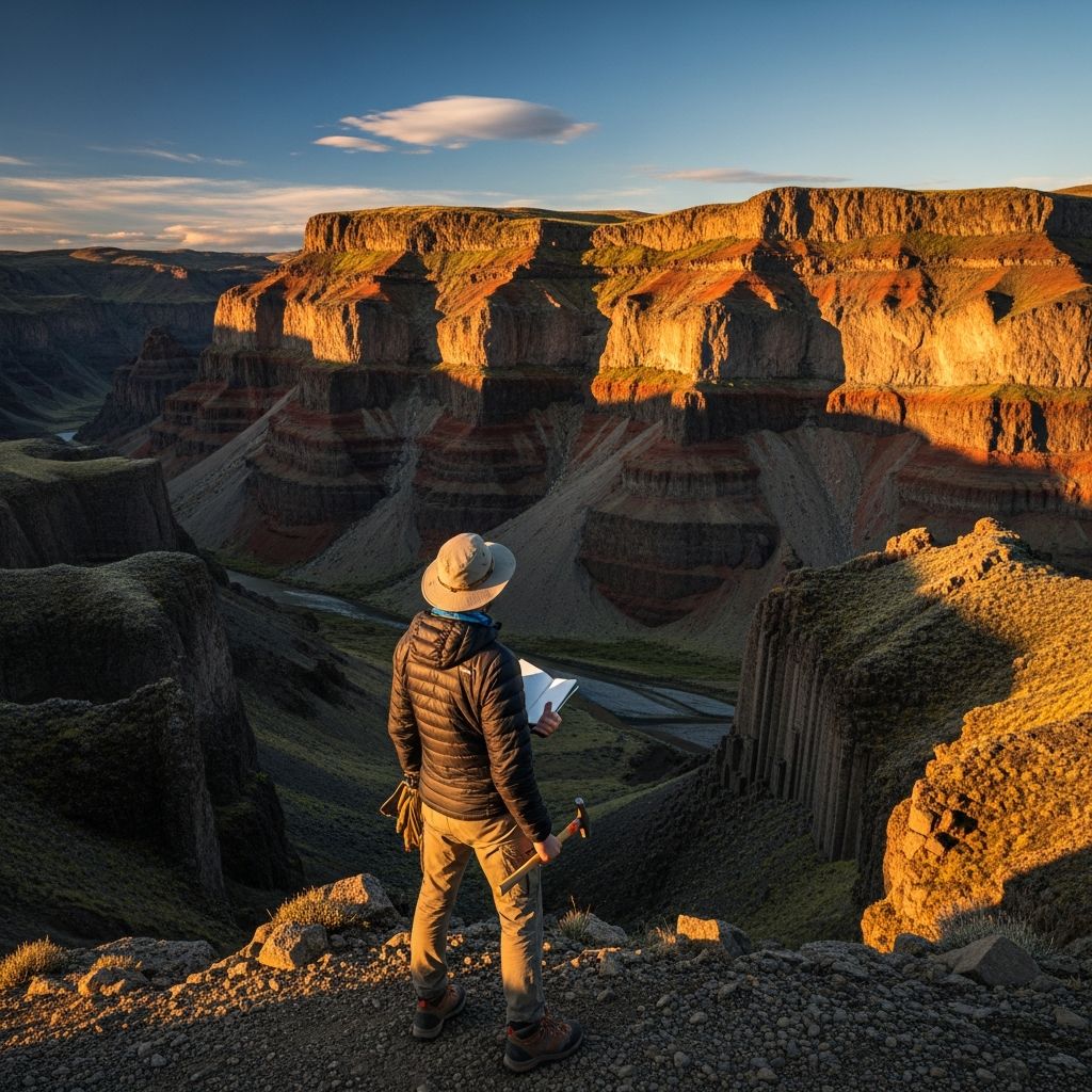
Exploring the world through a geological lens turns every landscape into a living textbook of Earth’s history. Whether hiking rugged trails or driving scenic routes, adopting a geologist’s mindset reveals layers of volcanic activity, ancient sediments, and tectonic forces shaping our planet. This guide equips you with strategies to observe, document, and appreciate these wonders safely and effectively.
Mastering the Art of Geological Observation
The foundation of geological travel lies in keen observation. Train your eye to discern rock types, formations, and landforms that tell tales of cataclysmic events millions of years ago. Start by scanning horizons for patterns: rugged peaks signal uplift from tectonic collisions, while flat plains hint at erosion or sediment deposition.
- Identify basic rock categories: Igneous rocks like granite form from cooled magma; sedimentary layers, such as limestone, stack from compressed debris; metamorphic rocks like marble emerge under intense heat and pressure.
- Spot structural clues: Fault lines appear as sharp breaks in rock layers, folds as wavy bends indicating past compression.
- Read the landscape: Canyons expose cross-sections of time, waterfalls carve through resistant strata, and coastal cliffs showcase wave-eroded sequences.
Practice by pausing at viewpoints. Ask: What forces created this? How old might it be? This habit elevates casual sightseeing to scientific inquiry, fostering deeper connections with nature.
Essential Gear for the Field Geologist Traveler
Packing like a geologist ensures you’re prepared for hands-on discovery without excess baggage. Prioritize lightweight, multifunctional items that withstand rugged conditions.
| Item | Purpose | Why Essential |
|---|---|---|
| 10x Hand Lens (Loupe) | Examine mineral grains and textures | Reveals microscopic details invisible to the naked eye |
| Rock Hammer | Break and sample rocks safely | Geologists’ primary tool for close inspection |
| Field Notebook & Waterproof Pens | Sketch maps, note observations | Records data for later analysis; withstands rain |
| Compass & GPS Device | Navigate precisely in remote areas | Plots exact locations of finds |
| Sturdy Backpack with Hydration Bladder | Carry gear on long hikes | Supports 5-10 mile daily treks comfortably |
| Safety Kit: First Aid, Whistle, Headlamp | Emergency preparedness | Critical for isolated fieldwork |
Layer clothing for variable weather—quick-dry synthetics over cotton—and include polarized sunglasses to cut glare on watery exposures. A polarized lens reveals stress patterns in minerals and underwater features.
Planning Your Geological Itinerary
Strategic planning maximizes geological rewards. Research destinations via geological surveys and academic maps to target high-yield sites. Balance driving, hiking, and rest; aim for 5-10 miles of daily activity, starting with morning briefings on upcoming features.
- Pre-trip research: Use USGS maps for U.S. sites or equivalent national agencies abroad to pinpoint quarries, outcrops, and fossil beds.
- Seasonal timing: Spring or fall avoids extreme heat/cold; low water reveals riverbed strata.
- Permits and ethics: Check for collection bans in parks; follow Leave No Trace to preserve sites.
- Group dynamics: Solo for flexibility, guided tours for expertise—many led by PhD geologists offer lectures en route.
Build flexibility into schedules for weather delays or serendipitous finds, like roadside exposures from roadcuts.
Iconic North American Geological Road Trips
North America’s diverse geology shines on road trips weaving through volcanic arcs, glacial scars, and sedimentary basins. These routes combine accessibility with profound exposures.
Pacific Northwest Volcanic Loop
Begin in Seattle, heading to Mount Rainier National Park for stratovolcano majesty and glacier views. Cross the Cascades to Palouse Falls, where massive basalt floods from ancient eruptions layer the canyon walls. Continue to Craters of the Moon in Idaho for lunar-like lava fields, then loop via Yellowstone’s geysers and caldera—Earth’s active supervolcano hotspot.
Grand Canyon to Zion Stratigraphic Traverse
Drive the Southwest corridor: Grand Canyon’s 1.8-billion-year Vishnu Schist at the base rises through colorful Paleozoic layers. Transition to Zion’s Navajo Sandstone cliffs, sculpted by ancient dunes, and Bryce Canyon’s hoodoos—erosional spires from frost-wedging.
Appalachian Fold Belt Explorer
From Shenandoah to Great Smoky Mountains, trace ancient mountain-building with folded quartzites and shales. Detour to Skyline Drive for panoramic overviews.
These paths total 1,000-2,000 miles, ideal for 1-2 weeks, with camping or lodges near key outcrops.
Global Hotspots for Geological Pilgrimage
Beyond North America, world-class sites beckon. Iceland’s rift zones display active seafloor spreading; Greece’s volcanic isles and fossil-rich geoparks offer Mediterranean drama. New Zealand’s fiords and Alps showcase subduction drama.
- Hawaii: Active shield volcanoes at Kilauea pour fresh lava.
- Australia’s Pilbara: 3.5-billion-year-old stromatolites, life’s earliest evidence.
- Scotland’s Highlands: Moine Thrust illustrates continental collision.
Geotourism surges here, with expert-led tours interpreting time travel through strata.
Safety and Sustainability in the Field
Fieldwork demands vigilance. Assess terrain for rockfalls, flash floods; inform others of plans. Hydrate relentlessly on hikes, use sun protection at high altitudes.
Balance personal life: Pre-arrange family logistics like meal preps or carpools to ease absences. Ethical collecting—photograph more than you take—preserves sites for future explorers.
For families, integrate geology via kid-friendly hunts for fossils or minerals, turning trips educational.
Frequently Asked Questions (FAQs)
What beginner gear do I need for geological travel?
A hand lens, notebook, and hiking boots suffice initially. Add a rock hammer as skills grow.
Are guided geological tours worth it?
Yes, experts provide context, access restricted areas, and enhance safety on complex terrains.
How physically demanding are geology trips?
Expect 5-10 miles hiking daily on uneven ground; build fitness gradually.
Can I collect rocks legally?
National parks ban it; check state or private land rules. Prioritize photos.
Best apps for on-the-go geology?
Rock Identifier, USGS Field Guide, and GPS apps like Gaia for maps.
Turning Every Trip into a Geological Adventure
Embrace the geologist’s curiosity anywhere: urban quarries, beach pebbles, mountain passes. Document via photos, sketches, journals to build personal archives. Share findings online or with communities to inspire others. This approach not only enriches travels but cultivates stewardship for our dynamic planet.
References
- Geological Field Techniques for Roadside Outcrop Analysis — United States Geological Survey (USGS). 2023-05-15. https://pubs.usgs.gov/publication/ofr20231025
- National Geologic Map Database — U.S. Geological Survey. 2026-01-20. https://ngmdb.usgs.gov/ngmdb/ngmdb_home.html
- Geotourism Principles and Practices — Geological Society of America. 2024-08-10. https://pubs.geoscienceworld.org/gsa/books/book/2360
- Field Safety Guidelines for Geologists — American Geophysical Union. 2025-03-12. https://www.agu.org/Share-and-Advocate/Equity-Ethics-Diversity/Fieldwork/Fieldwork-Safety
- Volcanic Hazards in the Cascades — USGS Volcano Hazards Program. 2024-11-05. https://www.usgs.gov/programs/VHP/cascades-volcano-observatory

Medha Deb is an editor with a master's degree in Applied Linguistics from the University of Hyderabad. She believes that her qualification has helped her develop a deep understanding of language and its application in various contexts. Medha specializes in the areas of beauty, health, sports, and wellness and is committed to ensuring that the content on the website is…