
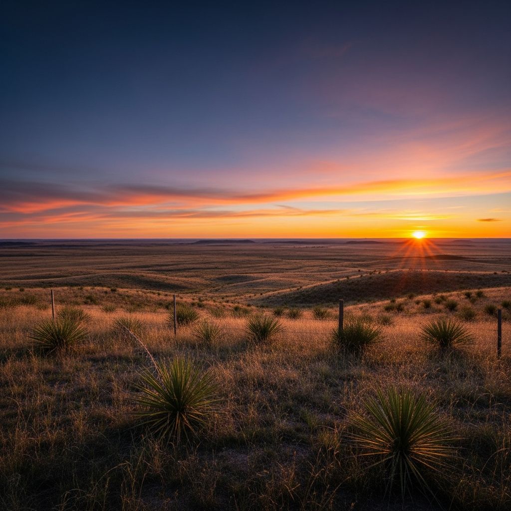
This expansive tableland, stretching across northwest Texas and eastern New Mexico, captivates with its sheer scale and subtle beauty. Covering over 30,000 square miles, it represents one of North America’s most remarkable landforms, blending geological antiquity with human history.
Deciphering the Name: From Spanish Explorers to Enduring Legends
The term ‘Llano Estacado’ carries layers of intrigue rooted in Spanish colonial encounters. ‘Llano’ simply denotes a flat plain, but ‘Estacado’ sparks debate among historians and linguists. Popular lore insists it means ‘staked plains,’ suggesting early travelers drove wooden stakes into the ground to maintain direction across this featureless expanse.
Francisco Vázquez de Coronado, the 16th-century conquistador, first documented these plains in a 1541 letter to Spain’s king, describing them as limitless, devoid of landmarks: ‘not a stone, nor bit of rising ground, nor a tree, nor a shrub.’ His Native guides reportedly shot arrows ahead to stay on course, underscoring the disorienting vastness.
Alternative interpretations propose ‘palisaded plains,’ evoking fortress-like escarpments visible from afar, resembling stockades. Approaching from the Canadian River breaks west of Amarillo, the caprock rise mimics an impenetrable wall. Scholar John Miller Morris argues Coronado never used ‘Llano Estacado’ precisely, theorizing ‘estacar’ referred to hobbling horses at night due to absent vegetation.
- Staked Plains Theory: Navigation aids in a trackless sea of grass.
- Palisaded Plains: Escarpment’s fort-like appearance.
- Horse-Hobbling: Practical need to secure animals overnight.
These narratives, immortalized in songs like Gary P. Nunn’s tribute to the land’s spirit, highlight its mythic status.
Geological Foundations: A Relic of Ancient Uplift
Formed millions of years ago, the Llano Estacado is a southern arm of the High Plains, a mesa sloping southeast at 8-10 feet per mile. Elevations climb from 2,500 feet in the southeast to over 4,200 feet northwest.
Its bedrock stems from late Paleozoic deposits, overlaid by Cenozoic sediments from Rocky Mountain erosion. Uplift 70 million years ago deposited Tertiary and Pleistocene alluvium via eastward streams, creating the Ogallala Aquifer—a vital underground reservoir.
Escarpments define its edges: Canadian River valley north, Caprock east, Mescalero west, merging south into the Edwards Plateau. Eolian sands, marls, and loams mantle the surface, fostering shortgrass prairie.
| Boundary | Description | Elevation Range |
|---|---|---|
| North | Canadian River escarpment | 3,500-4,200 ft |
| East | Caprock escarpment | 2,500-3,500 ft |
| West | Mescalero escarpment | 3,000-4,000 ft |
| South | Gradual merge to Edwards Plateau | 2,500-3,000 ft |
This isolation from Rocky runoff, via Pecos River piracy, shaped its semiarid character.
Indigenous Heritage: Comanches, Apaches, and Buffalo Lands
Long before Europeans, the Llano sustained vibrant Native cultures. Comanche and Apache tribes dominated, with the region marking a contested frontier near the Pecos River. Vast grasslands supported massive buffalo herds, central to their nomadic hunter-gatherer life.
These plains offered hunting grounds, water from playa lakes, and strategic mobility. Comanches, expert horsemen, ruled until the 1870s, when U.S. military campaigns displaced them.
Archaeological traces reveal millennia of occupation, from Paleo-Indians to historic tribes, underscoring the land’s enduring human pull.
European Encounters: Coronado to Pioneer Settlement
Coronado’s 1541 trek etched the Llano into history as an impenetrable barrier. Later explorers deemed it part of the ‘Great American Desert,’ unfit for settlement.
By the 19th century, buffalo hunters and ranchers ventured in. The 1870s buffalo slaughter ended Native dominance, paving settler paths. Railroads and windmills tapped the Ogallala, enabling ranching.
Early immigrants marveled at remaining grasslands, but rapid change followed Comanche removal just 125 years ago.
Agricultural Revolution: Irrigation and the Cotton Empire
Today, the Llano thrives as an agribusiness hub, producing cotton, sorghum, wheat, and corn. Center-pivot irrigation, drawing from the Ogallala, greens vast circles amid the brown.
This 32,000-square-mile plateau—250 miles north-south, 150 east-west—boasts a caprock crown separating it from lowlands. Yet, overpumping depletes the aquifer, threatening sustainability.
- Cotton: Leading crop, dubbed the ‘White Gold’ region.
- Sorghum & Grain: Drought-resistant staples.
- Livestock: Cattle grazing on irrigated pastures.
From desert myth to breadbasket, human ingenuity reshaped it.
Environmental Dynamics: Playas, Winds, and Water Challenges
Shallow playa lakes dot the surface, recharging the Ogallala and hosting wildlife. Strong winds sculpt dunes and aid evaporation, defining the semiarid climate.
Climate shifts, wetter eras carved nearby Palo Duro Canyon into Ogallala layers. Modern farming erodes topsoil, demanding conservation.
Cultural Echoes: Literature, Music, and Legacy
The Llano inspires art, from Coronado’s letters to folk songs celebrating its rivers and people. It symbolizes resilience amid harsh beauty.
Frequently Asked Questions (FAQs)
What does ‘Llano Estacado’ literally mean?
It translates to ‘Staked Plains’ or ‘Palisaded Plains’ in Spanish, with origins tied to navigation challenges or escarpment views.
How large is the Llano Estacado?
Over 30,000 square miles, roughly 250×150 miles across Texas and New Mexico.
What is the Ogallala Aquifer’s role?
It supplies irrigation water from ancient Rocky Mountain sediments, fueling agriculture but facing depletion.
Which Native tribes lived there?
Primarily Comanches and Apaches, relying on buffalo herds until the late 1800s.
Is it still a desert?
No, intensive farming has transformed it into a productive agricultural heartland.
References
- El Llano Estacado: The Vast, Staked, Palisaded Plain — Texas Standard. 2023-06-15. https://www.texasstandard.org/stories/el-llano-estacado-the-vast-staked-palisaded-plain/
- The Llano Estacado — Meredith McClain, PhD. 2022-01-10. http://www.meredithmcclainphd.com/llano-estacado.php
- Llano Estacado: Texas History Study Guide — Fiveable. 2025-03-20. https://fiveable.me/hs-texas-history/key-terms/llano-estacado
- Llano Estacado — Texas State Historical Association. 2024-11-05. https://www.tshaonline.org/handbook/entries/llano-estacado
- LLANO ESTACADO — Encyclopedia of the Great Plains, University of Nebraska-Lincoln. 2023-07-12. https://plainshumanities.unl.edu/encyclopedia/doc/egp.pe.036.html
- Llano Estacado in New Mexico and Texas Vs. YEC and Flood Geology — Jesus in History and Science. 2024-02-28. https://jesusinhistoryandscience.com/?p=2163

Medha Deb is an editor with a master's degree in Applied Linguistics from the University of Hyderabad. She believes that her qualification has helped her develop a deep understanding of language and its application in various contexts. Medha specializes in the areas of beauty, health, sports, and wellness and is committed to ensuring that the content on the website is…