
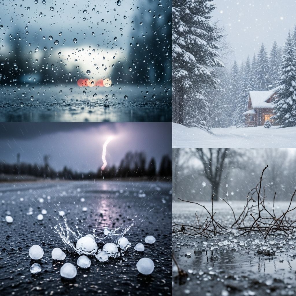
Precipitation represents any form of water—liquid, solid, or mixed—that descends from the atmosphere to Earth’s surface, shaping weather, ecosystems, and human activities worldwide. Understanding its varieties reveals the intricate dynamics of atmospheric processes.
Fundamental Mechanisms Driving Precipitation
Precipitation arises primarily through three mechanisms: convective, stratiform (or cyclonic), and orographic. Each produces distinct patterns influenced by air movement, temperature, and topography.
Convective Precipitation: Intense and Localized
Convective precipitation develops when warm, moist air rises rapidly due to surface heating, often in unstable atmospheres. As it ascends, decreasing pressure causes expansion and cooling, leading to condensation into clouds like cumulonimbus. This process unleashes powerful updrafts, resulting in heavy, short-lived downpours typical of summer thunderstorms.
These events cover small areas but deliver high rainfall rates, sometimes exceeding inches per hour. Tropical regions see much convective activity, where towering clouds sustain intense precipitation before dissipating.
Stratiform or Cyclonic Precipitation: Widespread and Steady
Stratiform precipitation, often linked to cyclonic systems, occurs as large air masses interact along weather fronts. Warm, moist air overrides cooler air in low-pressure zones, cooling gradually and forming widespread layered clouds (nimbostratus). This yields lighter, prolonged rain over vast regions.
Warm fronts produce extended drizzle, while cold fronts trigger more abrupt showers. Most global precipitation stems from these expansive systems, sustaining rivers and agriculture.
Orographic Precipitation: Terrain-Induced Rainfall
When moist winds encounter elevated landforms like mountains, air is forced upward, cooling adiabatically to form clouds and precipitation on the windward side. This orographic lift creates rain shadows on leeward slopes, influencing regional climates dramatically.
Mountain ranges amplify moisture extraction, fostering lush windward vegetation contrasted by arid interiors.
Liquid Forms of Precipitation
Liquid precipitation dominates warmer conditions, falling as drops through above-freezing air layers.
Rain: The Most Common Form
Rain forms when cloud droplets coalesce into drops heavy enough to fall, passing through air warmer than 32°F (0°C). Droplet sizes vary from fine mist to heavy showers, with rates classified as light (<0.1 in/hr), moderate (0.1-0.3 in/hr), or heavy (>0.3 in/hr).
Nimbo-stratus or cumulonimbus clouds often produce rain, essential for water cycles yet capable of flooding.
Drizzle: Fine and Persistent
Drizzle consists of tiny droplets (<0.5 mm) falling from low stratus clouds, reducing visibility and accumulating slowly. Common in marine climates, it feels misty but totals measurable moisture over time.
Frozen and Mixed Precipitation Types
Winter weather introduces solid and transitional forms, determined by temperature profiles between cloud and ground.
Snow: Crystalline Winter Gift
Snowflakes emerge when water vapor deposits directly onto ice nuclei in subfreezing clouds, forming intricate crystals. If the entire atmospheric column below remains below freezing, snow reaches the ground intact. Flake shapes—dendrites, plates—depend on humidity and temperature.
Snowpack insulates soil and replenishes aquifers upon melt.
Sleet (Ice Pellets): Bouncing Ice Grains
Sleet develops as partially melted snowflakes traverse a shallow freezing layer aloft, refreezing into pellets before ground contact. These small, hard balls bounce and are lighter than hail, signaling mixed-layer atmospheres.
Freezing Rain: Slick Hazard
Supercooled raindrops freeze instantly upon striking subfreezing surfaces, coating roads, trees, and power lines in glaze ice. A warm cloud layer atop thin cold surface air enables this dangerous phenomenon, causing outages and travel chaos.
Graupel and Ice Crystals: Lesser-Known Solids
Graupel (soft hail) forms when supercooled droplets freeze onto snowflakes in convective clouds. Ice crystals are fragile prisms falling from clear skies in high, cold cirrus layers.
Hail: Thunderstorm’s Extreme Product
Hailstones are layered ice balls forged in supercell thunderstorms. Updrafts exceeding 56 mph suspend droplets, which freeze in cold updrafts, grow layers cycling through freeze-thaw zones, and plummet when too heavy.
Golf-ball to softball sizes wreak crop and property damage; larger “megacryometeors” are rare but devastating. Hail remains frozen through warm layers due to rapid descent.
Atmospheric Temperature Profiles and Outcomes
Precipitation type hinges on vertical temperature structure:
| Scenario | Description | Resulting Precipitation |
|---|---|---|
| All warm below cloud | Cloud to ground >32°F | Rain |
| Surface cold layer | Shallow freeze near ground | Freezing rain |
| Freezing aloft layer | Melt-refreeze mid-column | Sleet |
| All cold column | Entire path <32°F | Snow |
| Strong updrafts | Cyclical freeze in clouds | Hail |
This table illustrates how subtle profile shifts yield diverse outcomes.
Measuring and Classifying Intensity
Intensity gauges use rate (mm/hr or in/hr) or visibility. METAR codes standardize reports: RA (rain), SN (snow), PL (sleet), GR (hail), FZRA (freezing rain).
- Light: Mist-like, minimal accumulation.
- Moderate: Steady, noticeable effects.
- Heavy: Torrential, potential flooding/disruption.
Global and Regional Variations
Tropics favor convective deluges; mid-latitudes see cyclonic fronts; mountains enhance orographic yields. Climate change may intensify extremes, boosting convective bursts while shifting snowlines.
Impacts on Daily Life and Environment
Precipitation sustains life but challenges infrastructure. Rain refills reservoirs; snow aids skiing yet strands travelers; ice storms topple grids. Forecasting refines via radar and models.
Frequently Asked Questions (FAQs)
What causes different precipitation types?
Temperature profiles, air mass interactions, and lift mechanisms (convection, fronts, terrain) dictate forms, from rain to hail.
Why does freezing rain cause more damage than sleet?
It forms heavy, clear ice sheets versus sleet’s pellets, weighing down branches and lines.
Can hail form in winter?
Rarely; hail requires summer-like thunderstorms with strong updrafts, not typical cold outbreaks.
How is precipitation intensity measured?
Via rain gauges for rate, or visibility/reduced acuity for snow/ice; codes like RA, SN standardize aviation reports.
What’s the role of mountains in rainfall?
Orographic lift squeezes moisture, drenching slopes and shadowing opposites.
References
- Precipitation Basic Concepts — U.S. Army Corps of Engineers, Hydrologic Engineering Center. 2023. https://www.hec.usace.army.mil/confluence/hmsdocs/hmstrm/meteorology/precipitation/precipitation-basic-concepts
- Precipitation Types — Wikipedia (informed by meteorological standards). 2025-01-15. https://en.wikipedia.org/wiki/Precipitation_types
- Precipitation Types & Formation — Study.com Academy. 2024. https://study.com/academy/lesson/video/precipitation-types-formation.html
- The Science Behind Types of Precipitation — South Carolina Public Radio. 2025-01-10. https://www.southcarolinapublicradio.org/sc-news/2025-01-10/the-science-behind-pretypes-of-precipitation-and-how-they-form
- Types of Precipitation — Baltimore Woods Nature Center. 2024. https://baltimorewoods.org/types-of-precipitation/
- How Various Types of Precipitation Form — FOX 17 Online. 2024. https://www.fox17online.com/weather/weather-articles/how-various-types-of-precipitation-form

- Integrated M.A. in Applied Linguistics, University of Hyderabad
- 5+ years in editorial, instructional, SEO, and research-based writing
Sneha is a relationships and lifestyle writer with a strong foundation in applied linguistics and certified training in relationship coaching. She brings over five years of writing experience to theskillvault, crafting thoughtful, research-driven content that empowers readers to build healthier relationships, boost emotional well-being, and embrace holistic living. Her writing and insights reflect the belief that beauty, happiness, and wellness…