
Understanding Freezing Rain: A Distinctive Winter Precipitation Event
Freezing rain represents one of the most hazardous forms of winter precipitation, distinct from other frozen precipitation types due to its unique physical properties and formation mechanism. Unlike sleet or snow, freezing rain consists entirely of liquid water droplets that maintain a liquid state despite temperatures well below the freezing point. This phenomenon, known as supercooling, creates a deceptive precipitation that appears to be ordinary rain until it strikes surfaces and transforms instantly into a treacherous coating of ice. The scientific community recognizes freezing rain as a critical meteorological event requiring specialized understanding for weather forecasting and public safety preparation.
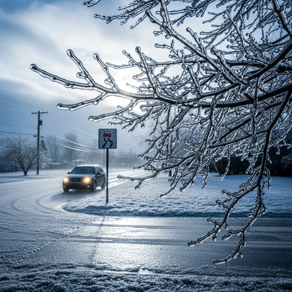
The defining characteristic of freezing rain is its ability to coat all exposed surfaces with a smooth, transparent layer of ice called glaze ice. This ice accumulation, which can reach several centimeters in depth during severe events, adheres strongly to trees, power lines, aircraft, automobiles, and infrastructure. The transparent nature of glaze ice distinguishes it visually from other ice types, creating a deceptively beautiful appearance that belies the significant hazards it presents to modern society.
The Atmospheric Architecture Behind Freezing Rain Formation
The development of freezing rain depends upon a very specific vertical temperature structure in the atmosphere that rarely occurs in nature. Meteorologists identify several distinct layers that must align precisely for freezing rain to occur rather than other forms of precipitation. Understanding these atmospheric layers provides essential insight into why freezing rain events remain relatively uncommon despite their dramatic impact when they do occur.
The process typically begins at cloud level, where precipitation initially forms as snow or ice crystals. This upper atmospheric layer maintains temperatures well below freezing, usually around or below negative 10 degrees Celsius. As these ice crystals begin their descent through the atmosphere, they encounter a warm air mass positioned at middle altitudes, typically centered around the 800 millibar pressure level. This warm layer, which may extend several hundred meters vertically, contains temperatures above freezing. When falling ice crystals pass through this warmer air, they undergo a complete phase transition from solid ice to liquid water droplets through the process of melting.
Following the warm middle layer, precipitation encounters a second critical atmospheric component: a shallow layer of subfreezing air situated just above the ground surface. This layer maintains temperatures below zero degrees Celsius, creating an environment where liquid water droplets cool to subzero temperatures while retaining their liquid state. The depth of this subfreezing layer near the surface proves crucial in determining whether freezing rain, sleet, or another precipitation type reaches the ground. If the subfreezing layer remains thin, falling raindrops lack sufficient time and distance to refreeze into solid ice particles before impact. Instead, they arrive at ground level as supercooled liquid droplets, ready to freeze upon contact with any surface.
The Physics of Supercooled Raindrops and Surface Freezing
Supercooling represents a fascinating state of matter where liquid water exists at temperatures below its normal freezing point. This occurs because water droplets require a nucleation site or surface irregularity to initiate the phase transition from liquid to solid. In the atmosphere, where water droplets remain relatively pure and encounter few particles upon which ice crystals can form, water can remain liquid even at temperatures of negative 10 degrees Celsius or colder.
The moment supercooled raindrops strike a surface—whether ground, vegetation, electrical infrastructure, or vehicles—they encounter the nucleation opportunity they have lacked. Upon impact, the water droplets instantly freeze through the nucleation process, transforming from liquid to solid state in a fraction of a second. This instantaneous freezing causes the drops to spread briefly across the surface before solidifying, creating a smooth, continuous layer of ice that bonds strongly to the underlying substrate. A single raindrop spreads across the surface momentarily before locking into place, and successive droplets build upon previous layers, gradually creating thicker ice accumulations.
Meteorological Patterns That Produce Freezing Rain Events
Freezing rain does not develop randomly but rather requires specific atmospheric configurations that position cold and warm air masses in precise relationships. Meteorologists have identified several recurring weather patterns that reliably generate the conditions necessary for freezing rain.
Warm Front Advancement and Cold Air Entrapment
One primary pattern involves the approach of a warm front when a low-pressure system moves across specific geographical regions. As warm air masses advance toward areas occupied by dense, cold air near the surface, the warm air often moves overhead without initially displacing the cold surface layer. This vertical configuration—with subfreezing air trapped at ground level and warm air aloft—creates ideal conditions for freezing rain. This pattern occurs frequently in North America when low-pressure systems track from the Mississippi River Valley toward the Appalachian Mountains and St. Lawrence River Valley during cold season months.
Frontal Occlusion and Geographic Features
Frontal occlusion represents another significant meteorological process where a cold front overtakes a warm front, forcing warm air aloft while cold air becomes trapped in surface layers. Topographic features like mountain ranges and valleys enhance this effect. The Appalachian Mountains, for instance, frequently serve as a barrier that traps cold air masses against its eastern slopes while warm, moist Atlantic air flows over the mountains, creating the multi-layered temperature structure required for freezing rain.
Cold Air Damming and Cyclone-Anticyclone Positioning
Cold air damming occurs when easterly winds from the Atlantic Ocean hold dense, cold air masses against mountain ranges like the Appalachians while warm, moist air continues flowing over the cold air. The cyclone-anticyclone pattern, where a low-pressure system and high-pressure system position themselves in close proximity, creates strong pressure gradients that enhance wind flow and reinforce the vertical temperature structure necessary for freezing rain development.
Distinguishing Freezing Rain from Similar Precipitation Types
Winter precipitation exists in several distinct forms, and accurate identification of each type proves essential for understanding associated hazards and appropriate response measures.
| Precipitation Type | Formation Process | Ground Impact | Primary Hazard |
|---|---|---|---|
| Freezing Rain | Snow melts completely in warm layer, then supercools in thin subfreezing layer before impact | Smooth glaze ice coating surfaces | Extremely slippery conditions, power line damage |
| Sleet | Snow partially melts in shallow warm layer, refreezes in deep subfreezing layer | Bouncing ice pellets that accumulate like snow | Reduced visibility, treacherous footing, minor accumulation |
| Snow | Precipitation forms and remains frozen from cloud to ground | Accumulation of crystalline snowflakes | Visibility reduction, travel delays, structural weight |
The critical distinction between freezing rain and sleet involves the depth of the subfreezing layer near the surface. When this layer remains shallow, supercooled droplets reach the ground before refreezing into solid particles, resulting in freezing rain. When the subfreezing layer extends deeper, falling droplets have sufficient time and distance to refreeze into solid sleet particles that bounce upon impact rather than adhering to surfaces.
The Dangers and Disruptions of Freezing Rain Events
Despite often involving light precipitation accumulation, freezing rain events rank among the most destructive winter weather phenomena. The hazards stem not from precipitation volume but rather from the extreme adhesion and strength of glaze ice and the severity of conditions it creates.
Transportation Hazards
Glaze ice on roadways creates surface friction coefficients approaching those of bare ice on highly polished surfaces, making normal vehicle operation extremely hazardous. Even light freezing rain accumulation renders roads impassable, stranding vehicles and preventing emergency response. The transparent nature of glaze ice makes it invisible to drivers, creating a deceptive appearance of passable wet pavement when conditions are actually treacherous.
Infrastructure Damage
Heavy freezing rain accumulation exerts enormous weight on electrical transmission lines, telephone wires, and tree branches. Ice accumulations of just 25 millimeters can exceed the structural capacity of many electrical infrastructure components. Tree branches bend and snap under ice weight, falling onto power lines and causing widespread outages affecting millions of people. Extended power disruptions in cold weather create dangerous conditions for heating and emergency communications.
Aircraft Operations
Aircraft encounter particular danger from freezing rain both on the ground and in flight. Ice accumulation on wings and control surfaces disrupts aerodynamic function, while ice ingestion into engines causes damage. Freezing rain coating runways makes landing and takeoff extremely hazardous.
Ice Storms: When Freezing Rain Becomes a Major Disaster
When freezing rain events persist for several hours or longer, meteorologists classify them as ice storms. These extended events produce substantial ice accumulation and constitute major disaster events requiring emergency response and recovery efforts spanning weeks or months. The terminology distinction between freezing rain events and ice storms reflects the dramatic difference in impact between brief and extended periods of this precipitation type.
Geographic and Seasonal Patterns of Freezing Rain
Freezing rain exhibits distinct geographic preferences, occurring much more frequently in certain regions than others. In North America, the region extending from the central United States through the Great Lakes and into southeastern Canada experiences freezing rain most frequently. This region experiences the meteorological conditions necessary for freezing rain development during winter months when warm Atlantic air masses interact with cold continental air masses and geographic barriers like the Appalachian Mountains.
In the United Kingdom and other portions of Europe, freezing rain remains a rare phenomenon because the atmospheric conditions necessary for its formation develop infrequently. The specific combination of warm air aloft and subfreezing surface air that freezing rain requires does not occur as regularly in these regions.
Safety Measures and Preparation for Freezing Rain Events
Given the significant hazards presented by freezing rain, comprehensive preparation and appropriate response measures prove essential for protecting public safety and minimizing disruption to essential services.
- Travel Avoidance: During freezing rain warnings, avoid all non-essential vehicle travel. Glaze ice conditions make vehicle operation extremely hazardous regardless of driving skill or vehicle capability.
- Power Loss Preparation: Maintain adequate supplies for extended power outages, including alternative heating sources, bottled water, non-perishable food, flashlights, batteries, and first aid supplies.
- Infrastructure Inspection: Utility companies and tree care professionals should conduct pre-winter inspections and maintenance to strengthen electrical infrastructure and prune trees that might fail under ice weight.
- Backup Communication: Maintain charged mobile devices and consider battery-powered radios to receive emergency information during power outages.
- Heating Safety: Never use outdoor heating equipment indoors, as carbon monoxide risk increases during power outages when people attempt alternative heating.
- Ice Removal: Avoid attempting to remove ice from power lines; contact utility companies for professional assistance.
Meteorological Monitoring and Forecasting
Modern weather forecasting relies on specialized techniques and observations to detect developing conditions favorable for freezing rain. Meteorologists monitor upper-air measurements from weather balloons and satellites to identify the vertical temperature structure that supports freezing rain development. Computer forecast models project the movement of warm and cold air masses to predict the timing and location of freezing rain events. The METAR code FZRA indicates the presence of freezing rain in official weather observations and reports.
Frequently Asked Questions
Q: How does freezing rain differ from regular rain?
A: Freezing rain consists of supercooled water droplets that maintain liquid form despite subzero temperatures, freezing instantly upon surface contact. Regular rain falls from above-freezing clouds and reaches the ground as liquid water that only freezes if surface temperatures are below freezing.
Q: Why is freezing rain more dangerous than snow?
A: Freezing rain creates glaze ice with extreme adhesion and minimal friction, making surfaces treacherous even with light accumulation. Snow provides better friction characteristics. Additionally, ice accumulation weight on infrastructure proves more damaging than equivalent snow weight.
Q: Can meteorologists predict freezing rain events in advance?
A: Yes, meteorologists can typically identify developing conditions favorable for freezing rain several days in advance by monitoring upper-air patterns and low-pressure system movements. However, precise location and timing predictions require high-resolution computer models and become more accurate within 24 hours of the event.
Q: What should I do if I encounter freezing rain while driving?
A: If you encounter freezing rain conditions while driving, immediately find a safe location to pull over. Do not attempt to drive on glaze ice, as even anti-lock brakes and traction control provide minimal benefit. Wait for road treatment or consider alternative transportation.
Q: How thick can glaze ice accumulation become?
A: Glaze ice accumulation can reach several centimeters during extended freezing rain events. Accumulations of just 25 millimeters can cause significant damage to electrical infrastructure and tree branches.
Q: Why does freezing rain occur more frequently in some regions than others?
A: Freezing rain requires specific atmospheric conditions that develop more regularly in certain geographic regions. North America’s eastern regions experience these conditions frequently because of interactions between warm Atlantic air and cold continental air, especially near topographic barriers like the Appalachian Mountains.
References
- Freezing Rain — SKYbrary Aviation Safety. Accessed 2026. https://skybrary.aero/articles/freezing-rain
- Freezing rain — Wikipedia. Accessed 2026. https://en.wikipedia.org/wiki/Freezing_rain
- Freezing rain — Met Office. Accessed 2026. https://weather.metoffice.gov.uk/learn-about/weather/types-of-weather/rain/freezing-rain
- Freezing Rain — GLISA, University of Michigan. Accessed 2026. https://glisa.umich.edu/freezing-rain/
- What is the Difference between Sleet, Freezing Rain, and Snow? — National Weather Service. Accessed 2026. https://www.weather.gov/iwx/sleetvsfreezingrain

- Integrated M.A. in Applied Linguistics, University of Hyderabad
- 5+ years in editorial, instructional, SEO, and research-based writing
Sneha is a relationships and lifestyle writer with a strong foundation in applied linguistics and certified training in relationship coaching. She brings over five years of writing experience to theskillvault, crafting thoughtful, research-driven content that empowers readers to build healthier relationships, boost emotional well-being, and embrace holistic living. Her writing and insights reflect the belief that beauty, happiness, and wellness…